Street View Page on Peru
Google Street View is
available through Google Maps and Google Earth and provides panoramic views
along many streets in the world. It was started in 2007 in the United States
and has since expanded to include a large number of
countries. Some countries have objected to this form of data gathering and have
not allowed Google to take the imagery, Germany being the main hold-out.
Available Street View imagery available is shown as blue lines on Google Maps
once the so-called pegman has been activated. Images
are most often taken by car but a variety of other modes of transport have been
used. Once captured, the images are subsequently stitched together. In some
areas, Street View images are augmented by privately-done photospheres.
Outline
1.
Street View screen
captures
o First StreetView of Aeropuerto Internacional
Rodriguez Ballon
o Second StreetView of
...
o Third StreetView of
...
2.
Links to Street View
panoramas
o Link to first panorama
o Link to second panorama
o Link to third panorma
3.
TripGeo
Street View Animations
o Route from x to y
o Route from y to z
o Route from z to x
4.
Moore's Where to
Invade Next
o The value of travel
1 Street View Screen Captures
Aeropuerto
Internacional Alfredo Rodriguez Ballon
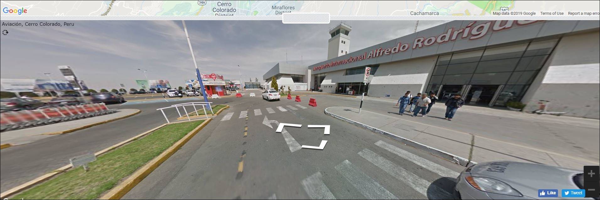
The Alfredo Rodriguez Ballon airport is the major international airport in Arequipa.
This view is from outside of one of the terminals with the flow of daily drop-off/pick-up
traffic.
Live Orchestral Concert in
Lima
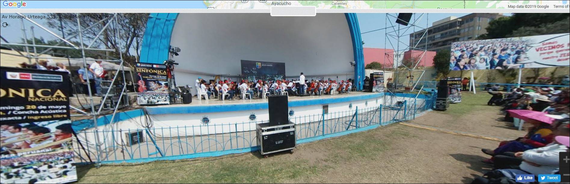
This view is from a live
concert venue in the Lima District. On the 20th of May, this orchestral
concert was played in front of a large crowd in what looks to be like a park.
Universidad Nacional de
San Antonio Abad del Cusco
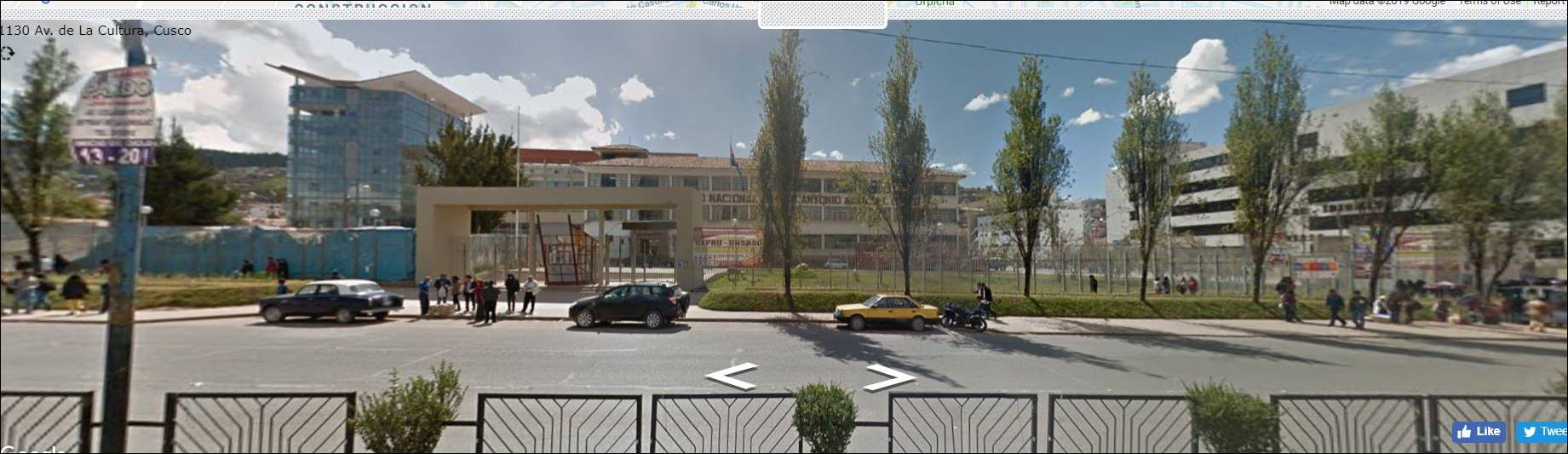
Out front of the
National University in Cusco, this reminds me a lot of most United States
campuses. There are people walking everywhere, some cars and some bikes. The large
buildings to the left and center look like where classes are held and a
possible meting center. The large building to the right kind of looks like a
parking garage but also could be classrooms.
2 Links to Street View Panoramas
Insert three links with
descriptions to Street View Panoramas here.
Example-1: View outside
of terminal at airport in Arequipa, Peru https://mapstreetview.com/#-9qbsj_-16lxqq_8i.0_-2g43
Example-2: Live Orchestral
music in Lima, Peru https://mapstreetview.com/#-76mng_-19va9b_9y.0_-6735
Example-3: View across
the street from the University in Cusco, Universidad
Nacional de San Antonia Abad del Cusco https://mapstreetview.com/#-81uhi_-16uczx_j.0_1f43
(Links were created by
going to the location and clicking on the Pegman (yellow
man in corner of Google Maps). Drag the Pegman over
the map and choose a location on a blue line that has a good point to view of
the feature. Once the Street View image is visible, copy the web address. In
Word, write out the name of the feature (e.g., Eiffel Tower in Paris),
highlighting the text, and then choose Insert Hyperlink and paste the address.)
3 TripGeo Streetview
Player
The TripGeo Streetview
Player tool stitches Google's panoramic street view data into
an animation. In the dialog, you can enter the start and end location of your
trip. When you click Preview, the route is marked on a map and the StreetView images will start playing. You can control the
method of travel, the pace of the timelapse, and the
distance between StreetView images.
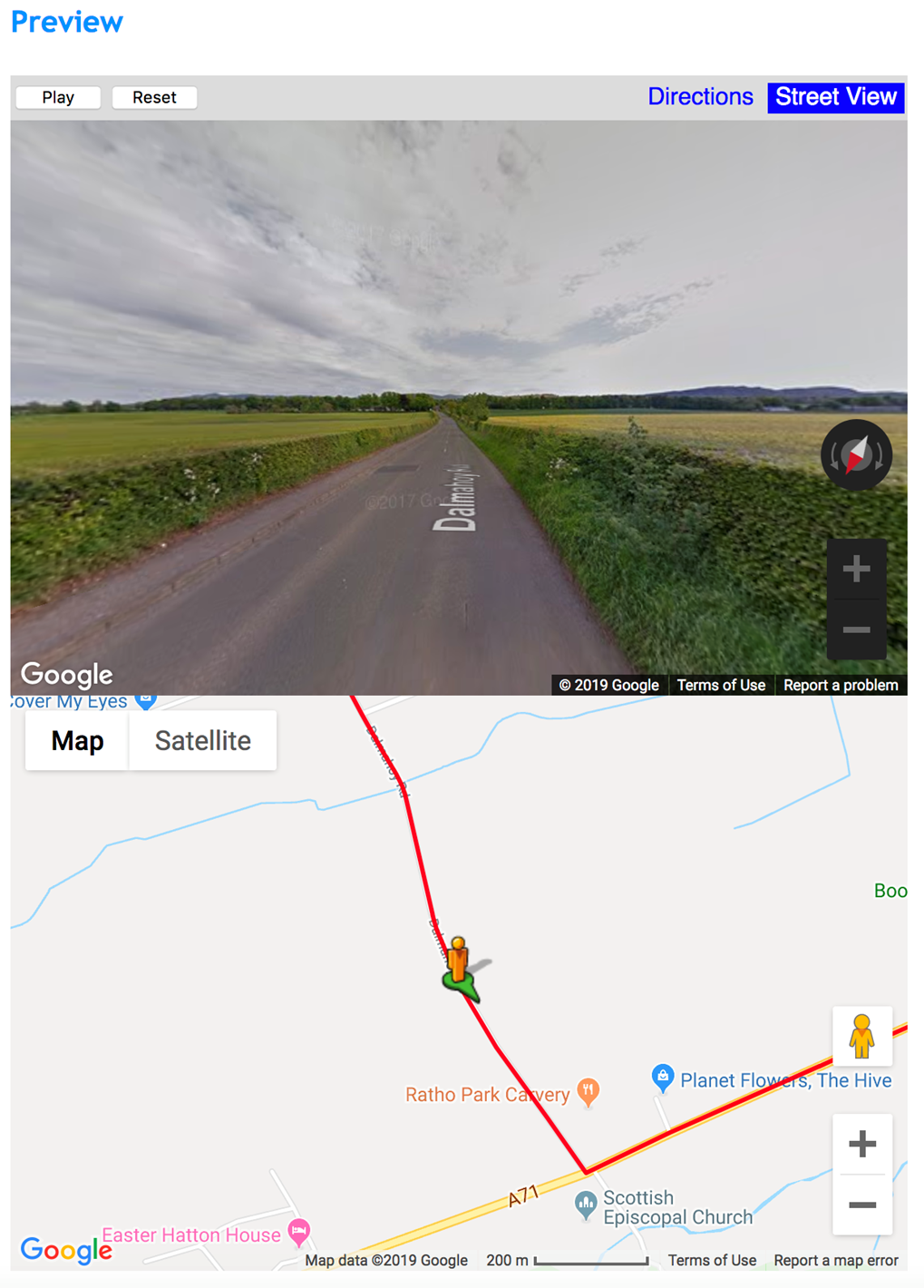
(This graphic was
created by taking a screenshot. You'll need to click on "Create Your
Directions Map" before this graphic appears.)
StreetView animation near Edinburgh, Scotland.
(This link was created
by clicking on View Directions and Map, and then on View Map. This gets you to
a page that displays the Street View and the map. Simply copy the address of
the page. In Word, enter the text for the link, highlight, and choose
"Insert Hyperlink". Paste the address. The address can also be attached
to the image – as above – using the same Insert
Hyperlink command.)
This Street View
animation takes us between two locations in Scotland. At the beginning, one
sees an older residential area. We then drive through the lush, green
countryside into a new residential area.
Route from Risso
Mall to Javier Prado Hospital
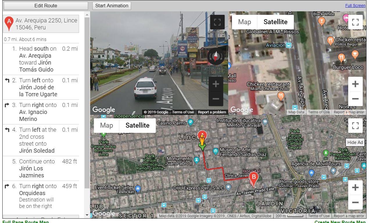
Link: https://www.mapchannels.com/routemaps2/routemap200.htm?saddr=av
arequipa 2250, lince&daddr=av
javier prado este
499&maptype=2&units=2&z=15&fi=50&fs=1&refresh=3&timeout=300&draggable=0&sw=240&svc=0&svz=2&atw=160&fgc=000000&bgc=CCCCCC&rc=FF0000&rw=3&ro=0.7
Desription:
This animation takes us from one of the shopping malls in Lima to a hospital
clinic. The animation shows some daily traffic for this fairly
short drive, totaling 17 minutes to drive just 5 miles.
Route from Museo de la Memoria to Estadio Cuidad de Cumana
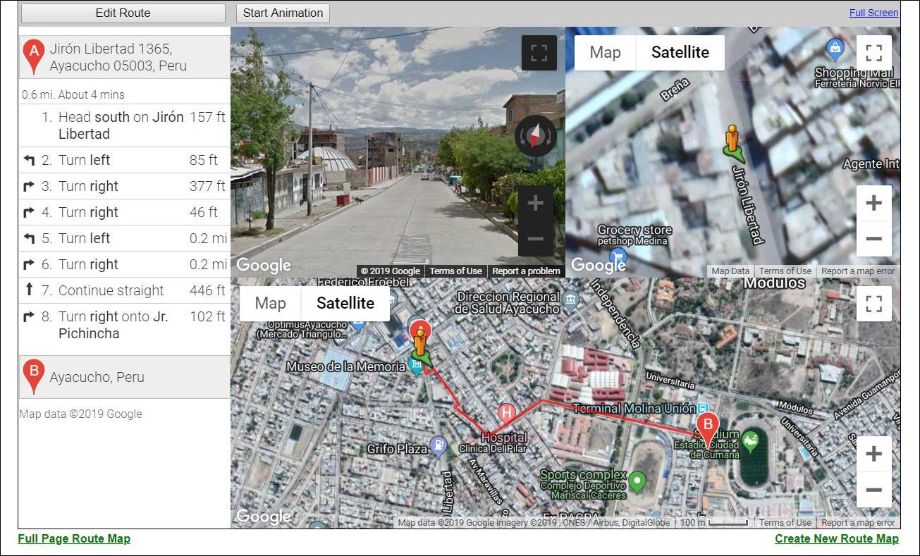
Link : https://www.mapchannels.com/routemaps2/routemap200.htm?saddr=jiron
libertad 1365, ayacucho&daddr=estadio cuidad de cumana,
ayacucho&maptype=2&units=2&z=15&fi=50&fs=1&refresh=3&timeout=300&draggable=0&sw=240&svc=0&svz=2&atw=160&fgc=000000&bgc=CCCCCC&rc=FF0000&rw=3&ro=0.7
Description: This route
is from Ayacucho, Peru and is from a museum within the city to a soccer stadium.
The stadium is home to a Peruvian club soccer team, while the museum is a history
museum that tells some of the stories from Peru’s civil war. These are two
tourist things to do within the city and would be a short commute from each.
Route from Golden Palace Hotel to Estacion Restaurant
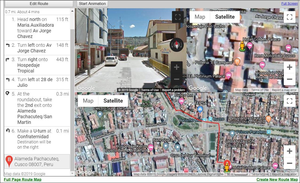
Link: https://www.mapchannels.com/routemaps2/routemap200.htm?saddr=hotel
golden palace, cusco&daddr=restaurante
la estacion, alameda pachacuteq,
cusco&maptype=2&units=2&z=15&fi=50&fs=1&refresh=3&timeout=300&draggable=0&sw=240&svc=0&svz=2&atw=160&fgc=000000&bgc=CCCCCC&rc=FF0000&rw=3&ro=0.7
Description: This route
in Cusco is from one of the hotels, Hotel Golden Palace, to a Peruvian restaurant.
It is a local restaurant, which is why they serve more traditional food. This
would be an average commute for an out-of-town traveler staying at the hotel,
to one of the local restaurants.
4 Moore's Where to Invade Next
Moore's documentary is
politically polarizing. Conservative columnists, such as Armon
White, are sharply critical of the movie. First, comment on the
validity of White's negative review. Then, putting aside politics, what can the
movie show us about the value of travel in understanding our own country.
The validity of his
comments ultimately depend on who is reading the article. Armon
White is someone who is standing his ground on issues
and some people will say his argument speaks the entire truth. Others will say
there is no validity behind what he says. I think politics aside we can take away
various policies from other nations and see how they were implemented and if
they would work here. For example, the drug crisis and African immigration
issues brought up are two similar examples to issues here, that may be able to
be resolved in similar fashion.
Submitted by [your name] on [date].